• Intro
  • News
  • Index of Archived Posts
  • Queensferry History
  • Memorials
  • Commonwealth Graves
  • Interesting War Facts
  • Surrounding Areas
  • Port Edgar
  • WWI Timeline
  Queensferry at War

A Brief History of Duntarvie Castle - (Near Winchburgh)

1/8/2019

0 Comments

 
Picture
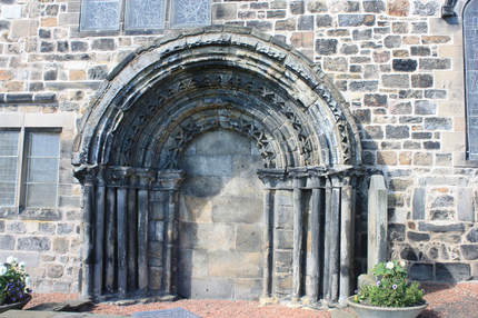
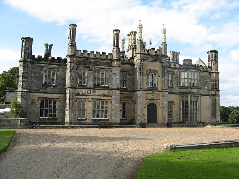
Image, Duntarvie Castle, from Duntarvie Castle website with permission.
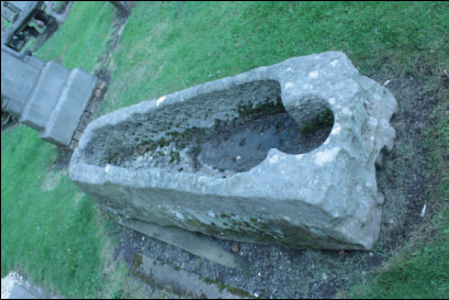
The historic Duntarvie Castle site dates back over 800 years.
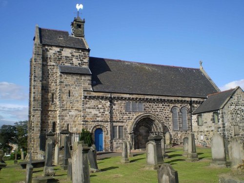
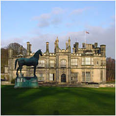
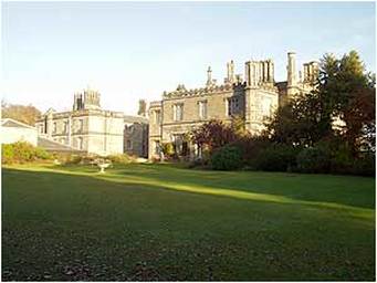
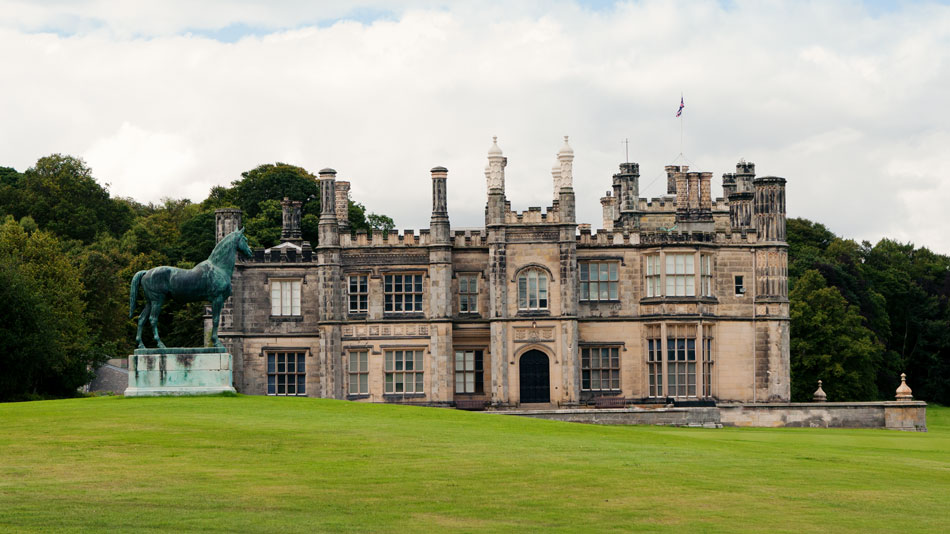
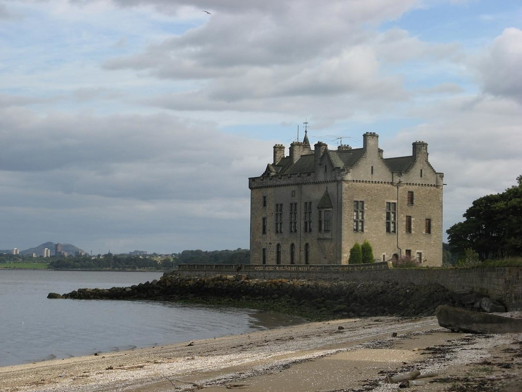
The Scots Renaissance mansion has a rich history, having previously been the residence of the both the Lindsay and Durham families.  It is located 1.5 kilometres north of Winchburgh and 9 kilometres east of Linlithgow.  A category ‘A’ listed building, constructed in the late 16th century, the building has been undergoing restoration since the 1990s.

The lands of Duntarvie were in possession of the Lindsays from 1527. A charter in 1605 transferred the property from the Lindsays to the Hamiltons of Abercorn. This 1605 charter shows the existence of the castle as early as 1212.
The Durham family initially held Duntarvie as tenants of the Hamilton family. However, according to Historic Environment Scotland, Duntarvie was then granted to James Durham in 1588. The building as it survives today was constructed shortly afterwards.

Picture
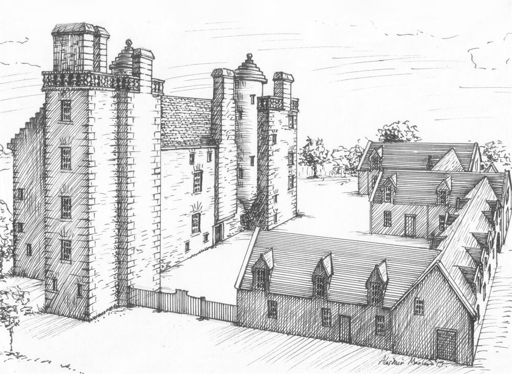
image from Duntarvie Castle website, with permission

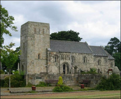
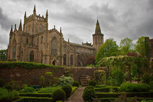
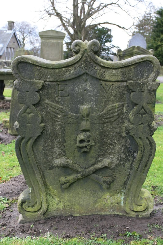
​One story is that the castle is haunted by the ghost of the Countess of Abercorn, and the apparition has reportedly been seen on the battlements, while disembodied voices are said to have been heard during the night. It is thought the identity of the Countess of Abercorn may be Marion Boyd, 1583 - 1632, who was married to Sir James Hamilton, 1575 – 1618, a staunch Protestant.  He was created 1st Earl of Abercorn in 1606.  His death proved a turning point in the family’s denominational adherence. She was a prominent Roman Catholic and after refusing to convert, was excommunicated by the Church of Scotland in 1628 and subsequently imprisoned in Edinburgh. Weakened by conditions during her captivity, she died in 1632 and is buried in Paisley Abbey. However, why would she haunt Duntarvie castle?
Picture
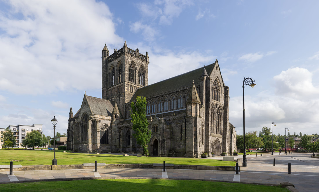
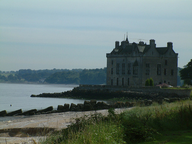
Image Paisley Abbey © Colin / Wikimedia Commons / CC BY-SA 3.0
In the 16th century, Alexander Durham and his heirs were given several royal appointments. Mary, Queen of Scots’ granted the position of ‘Master of the Prince’s Wardrobe’ to Alexander, who was also a Clerk in the Exchequer.  Prince James would later become King James VI and I, and therefore Alexander was responsible for the royal tailoring.
His son James took over his father’s offices in 1580 and served as Chamberlain for Linlithgowshire between 1595 and 1600. He witnessed several charters made by King James at Holyrood House.
The Durham family left Duntarvie in the 1770’s.

Mary Queen of Scots, from Duntarvie Castle website with permission
King James VI, public domain wikimedia
(Hover cursor over images for description)
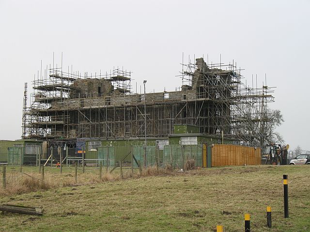
By 1826 the house was in the ownership of the Earl of Hopetoun and in need of urgent repair. It was uninhabited from the 1840s, and by the 20th century it was ruinous and roofless. 
Picture
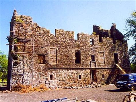
Image from Duntarvie Castle website with permission
In the late 20th century the castle was purchased by kiltmaker Geoffrey Nicholsby, (whose mother was a kilt maker during WW2),  with the intention of restoring it as a headquarters of his business Highland Crafts Ltd. Preparatory work began in 1994, but part of the east tower collapsed in January 1995.
In 2008 it was reported that Nicholsby had obtained scheduled monument consent for the restoration, but was placing the property on the market. However, no sale took place, and in 2013 Nicholsby sought planning permission for a "tank play park" in the grounds, that would fund the restoration. Though initially positive, West Lothian Council refused permission when no legal agreement could be reached on the restoration funding. In 2015, roof trusses were installed on the building. 

Picture
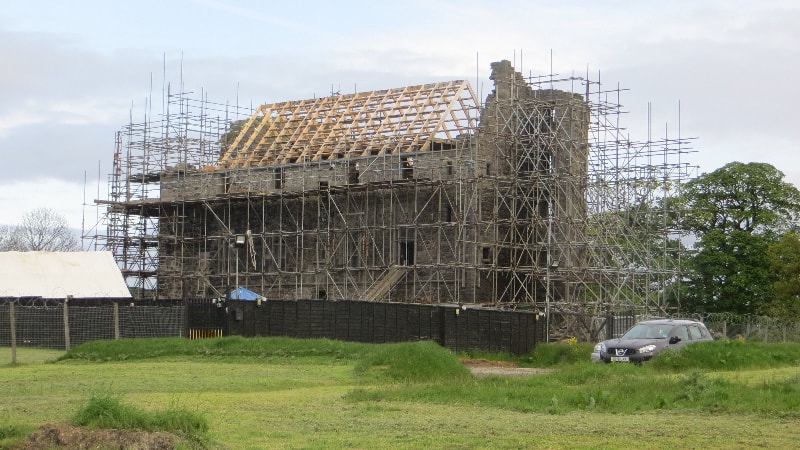
Duntarvie Castle 2015, from Duntarvie Castle website, with permission
Alongside their shop on Edinburgh’s historic Royal Mile, the tailoring workshops, offices and suite with showroom, are now based at Duntarvie Castle. His kilt company has made outfits for celebrities such as Robbie Williams, Sir Sean Connery and Dame Joan Collins.
Geoffrey has brought the tradition of fine tailoring back to the historic site – giving a new lease of life. 

Picture
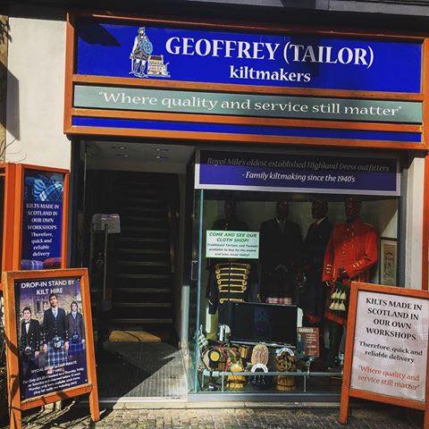
Image of shop from Geoffrey - Tailor Highland Crafts Facebook Page. https://www.facebook.com/GeoffreyKilt/
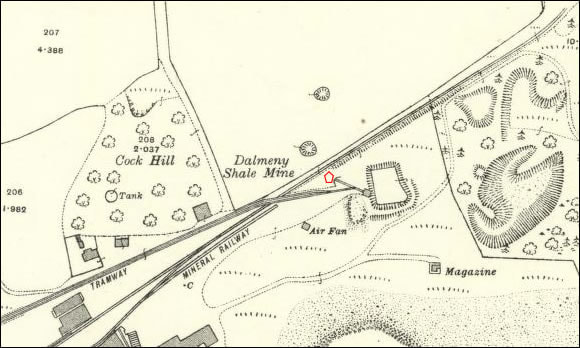
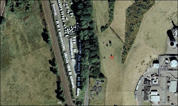
 In November 2016, the tartan for the Mars exploration programme was designed at the castle.  As a nod towards its involvement, a landmark on Mars has now been named ‘Duntarvie Castle’ in honour of the association. “Duntarvie Castle” is a area of local  bedrock in a geologic formation called “The Murray Formation”.
Picture
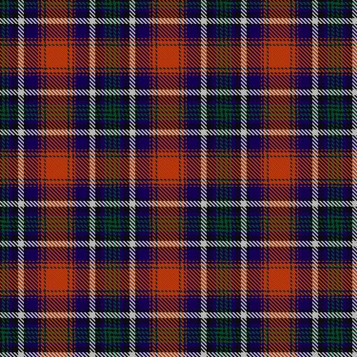
Image -Mars Exploration Tartan - with permission from Duntarvie Castle
Tartan Details - Mars Exploration
The information held within The Scottish Register of Tartans for the "Mars Exploration" tartan is shown below. 
Reference:
11658
Designer:
Geoffrey (Tailor) Highland Crafts
Tartan date:
25/08/2016
Registration date:
16 November 2016
Category:
Other
Restrictions​:
Yes.
To be woven only through Geoffrey (Tailor) Highland Crafts.
Registration notes:
Designed on behalf of Charles Cockell, Professor of Astrobiology, Edinburgh University, this tartan is intended to be worn during Mars science, exploration and outreach activities. Colours: the red background depicts the surface of Mars, the Red Planet; blue depicts the water-rich past of Mars and the presence of water, mainly as ice, on the planet today; the four green lines represent Mars, the fourth planet from the Sun, the presence of habitable conditions on the planet and the possible future presence of life in the form of human settlement; the thick white line represents the Martian poles, visible from the Earth, a conspicuous and important feature of the planet and its long-term climatic cycles.

Note: This tartan was registered in the official Scottish Register of Tartans.


Picture
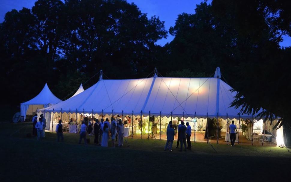
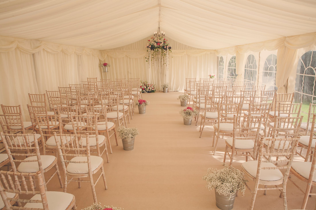
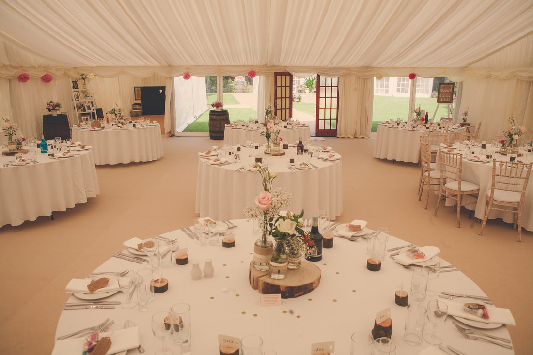
Image of Marquee, from Duntarvie Castle website with permission.
In 2018 the land was granted planning permission to build a permanent marquee structure on the property to host weddings and events. This allowed the site to begin to host weddings with temporary Marquees and in May 2019 the building of the new 'Summerhouse' style marquee began on the land to the rear of the property to enable a permanent offering for all events. 
Picture
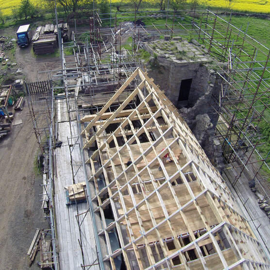
Image of roof work from Duntarvie Castle website, with permission.
Today Duntarvie castle is in the midst of an extensive restoration project to restore the castle to its former glory. The main castle building has been reconstructed to the roof level with the tower sections still requiring extensive work. The Great hall restoration is the current focus of the project with a local stonemason diligently restoring all original features to their former glory.  Once finished, the hall will be available for event bookings. In addition, it will enable couples to have a rustic setting for their marriage ceremony or photo.
Images from Duntarvie Castle website, with permission

 A stonemason is currently in the final stages of completing the rear castle entrance. The completion will enable guests to have access between the summerhouse marquee site and the great hall.
All events held at the venue help to support the ongoing restoration of Duntarvie castle. Therefore, every penny received from events goes into the Duntarvie castle restoration fund.
Duntarvie Castle website
© Queensferry History Group 2019
0 Comments

"Cheesetown"

1/6/2018

0 Comments

 
Did you know Kirkliston had the nickname "Cheesetown"?
Do you know why?
If not, here is the answer!
The building of our Railway Bridge took seven years. During that time the population of Queensferry and neighbouring villages such as Dalmeny and Kirkliston were completely swamped by a labour force of over 5,000. Kirkliston gained the nickname “Cheese Town” because of the huge quantities of cheese that had to be imported into the village every week to feed the largely Irish labour force.
Picture
© Queensferry History Group 2018
0 Comments

A Brief History of Kirkliston Parish

1/2/2018

1 Comment

 
The following information is extracted with permission, from the booklet, “Kirkliston – A Parish History”, by Donald Whyte (1991) -  (ISBN 0 9504329)
​ “Whose only wish is that the information in this book will benefit the ever increasing band of people interested in our rich heritage of local history and tradition”.
(Kirkliston was designated a Conservation Area in 1977. The conservation area all lies south of the main crossroads and Main Street. It focuses on the Parish Church, The Square and the High Street but also stretches south down to encompass the remote manse and the little group of buildings at Breastmill (1672). –Wikipedia)
Picture
The Parish of Kirkliston was originally called Liston, recorded in various forms, between 1163 and 1218. The form Temple Liston was first used about 1298 by an English chronicler undoubtedly because the Knights Templars possessed the central part of the parish, or the Barony of Liston. The Templars were suppressed in 1312 and their lands were given to the Knights Hospitalliers, the Order of the Knights of St John. (They are commemorated by the Maltese Cross in the arms of the Community Council, which were granted in 1991 - Wikipedia)
Picture
The name Liston is a compound word probably of the British “Lys” – signifying a county hall or manor place and the Saxon ”Tun” denoting a dwelling place. The prefix Kirk was attached to Liston during the 14th century.
Kirkliston has the nickname “Cheesetown”, commonly believed to be because the workmen from Kirkliston, working on the Rail Bridge between 1883 and 1890 invariably ate cheese with their bread. We are presumably asked to believe that the landladies of workmen from other villages did not make up “pieces” with cheese.
​ (Or perhaps it is because of the poem below written by Robert Burns. The oldest house in the town is Castle House which has a marriage lintel stone dated 1683. Robert Burns stayed there in 1787 and inscribed this verse on a window pane, now in a Vancouver museum:

"The ants about their cod employ their care
and think the business of the world is theirs.
Lo: waxen combs seem palace to bees.
And mites conceive the world to be cheese."
– Wikipedia)
Picture
Castle House

​Kirkliston Parish Church
The oldest surviving building in Kirkliston is the Kirk for which the town is named. The architecture indicates that it was built around 1200. 
Picture
Kirkliston Parish Church, Wikimedia Commons
It has a bricked up doorway which is an excellent example of a Romanesque style arched entrance, typical of the late 12th century with multiple concentric geometric and sculpted forms in each curve. It was bricked up during remodelling in 1822 and the old north doorway was moved to the eastern wall to become the main entrance. 
Picture
The 12th century south door - Wikimedia Commons
​The earliest gravestone in the kirkyard in Kirkliston is dated 1525 and there are some fine examples of 18th and 19th century carving and lettering. One of the most interesting headstones – noted by the Science Museum, South Kensington, London, - has a carved pediment, with, at either end a head wearing spectacles: the earliest known example of these in Scotland and possibly Britain. The stone bears the initials JB – JW and the date 1727.
Picture
The head piece of this gravestone at Kirkliston has at either end sculptured heads wearing spectacles
 In 1893 the Privy Council ordered the closure of the Old Kirkyard (except for widows or widowers whose spouses had already been interred) because the ground was “Contrary to decency” and a new cemetery was opened at the East end of the Glebe.
During the early part of the 19th century, around 1830, Kirkliston had two visits from grave robbers, who dug up freshly buried corpses to sell to the anatomy schools. In 1818 the resurrectionists carried off the bodies of a young widow who died in childbirth and a widow over 80 years of age. The Kirk Session made extensive enquiries and offered a reward of 20 guineas for information which would lead to the arrest of the robbers to no avail.  The Session built a watch-house at the east gate of the kirkyard and the vigilance of the parishioners prevented any further robberies taking place
Richard Burke and William Hare, 
​ infamous Edinburgh grave robbers and murderers in 1828. - image- wikimedia public domain
Witchcraft
Several Kirkliston witch trials are recorded. The most notable witch of Kirkliston Parish was Euphame McCalzean, daughter of Lord Cliftonhall. In July 1591 she appeared before the High Court in Edinburgh charged with crimes varying from common witchcraft to conspiring against the life of King James VI. Euphame was one of nine principals, five men and four women – at ‘the conjuring of cats’ whereby the witches claimed to have raised a great storm on 1st august 1590 that nearly wrecked the ship in which James VI and his bride Anne of Denmark were coming to Scotland from Oslo. Euphame was sentenced to be burned alive on the Castle Hill in Edinburgh. This was the most severe sentence ever pronounced by the court. Ordinarily condemned felons were strangled by the common hangman before being committed to the flames. She endured her fate with obstinancy to the last. Extracts from the Linlithgow Presbytery records show there were Kirkliston witches in the 1650’s. (The height of witch hunting was during the first half of the 1600’s. The crime of Witchcraft was abolished in Scotland in 1736. There had not been an execution of Witches during the seven years previous. The last witch execution in Scotland was Janet Horne in Dornoch in 1727.)


Picture
Burning of three witches in Baden, Switzerland (1585), by Johann Jakob Wick. Wikimedia public domain


Picture
Drambuie
From 1969 to 2001 the west side of Kirkliston was the site of the Drambuie Liqueur Factory providing employment for up to 150 workers, men and women, in  peak periods. There had also been a whisky distiller in the south of the town since 1795, which in later years became a malt factory. Both were demolished for housing. (The history of the Kirkliston Distillers are stories in themselves).
Picture
"Prince Charles Edward Stuart, 1720 - 1788. Eldest son of Prince James Francis Edward Stuart" Painted by William Mosman around 1750 - wikimedia public domain
According to family tradition the recipe for the world famous liqueur was given to the ancestors of the Mackinnon directors by Prince Chares Edward Stuart for their loyalty during the Jacobite Rising in 1745. While their allegiance cannot be doubted it is however possible that the Mackinnon’s were entrusted with the secret recipe because of their skills in measuring liquids. The production of Drambuie (Drambuidhe = yellow drink) began commercially in 1903 when Malcolm Mackinnon &Son established a business at 9 Union Street, Edinburgh.
Picture
Royalty free image
The Drambuie and Kirkliston Pipe Band was formed around the close of WWII, but went out of existence some 15 years later. A new band was formed in 1990 and a sponsorship arrangement was made with the Drambuie Liqueur Co. Ltd involving an input of around £40,000 which ensured a good beginning for the Drambuie Kirkliston Pipe Band which played at many events, festivals and processions. (Drambuie limited provided the group with one of the pipe band world’s best sponsorships, with the band supplied with two kilts and various combinations of uniforms. The band travelled extensively to raise awareness of the Drambuie brand around the world. It lost its sponsorship in 2005 when the Drambuie company withdrew sponsorship of the band after experiencing financial challenges and redeveloped its marketing and sponsorship programs. The band chose to disband rather than search for other funding. It had been set to start its first season in grade 1 after being officially upgraded. www.pipesdrums.com)
Picture
 Recorded music is available from various sites including Amazon and the band can be heard in YouTube 
©Queensferry History Group 2018
1 Comment

Dalmeny Snippets (up to 2005).

1/3/2017

0 Comments

 
A few Historical Snippets about Dalmeny, from Queensferry History Archives
Picture
Old image of Dalmeny Church, © Queensferry History Group
 1230 Dalmeny Kirk Built
1635 –July 9th-Charter granted separating Queensferry from the Parish of Dalmeny
                                 and erecting Queensferry into a separate parish.
1871 – Dalmeny Oil Company formed. In early 1900’s produced only crude oil and was
              quite profitable until the 1920’s.
1915 -  Dalmeny Oil Company absorbed by the Oakbank Oil Company.
1927 – Dalmeny Shale oil works closed. Eventually the area was occupied by Orr’s
               Piggery.
1945/46 – Royal Elizabeth yard built. Approximately 200 people employed.
1946 – Small brickworks were set up using spent shale.
1951 – Brickworks closed.
1938 – Old Miners Rows demolished. Householders rehoused at the Glebe.
1950 – Carlowrie Avenue and Crescent built.
1964 – Dalmeny Goods station closed.
1965 – Dalmeny’s local authority housing stock totalled 108: 42 pre-war
               and 66 post-war.
1966 – Smiddy converted to a private house.
1967 – Dalmeny Primary School built, and football pitch created.
1969 – Church bought old school.
1972 – Dalmeny Oil tank installation and Hound Point Oil Terminal created.
1975 – Dalmeny and Queensferry transferred to Edinburgh District Council.
1981 -  Downline waiting room at Dalmeny Station burned down.
1985 – Large garage and four private houses built in Standingstane Road.
2005 – Large garage in Standingstane Road burnt down.
2005 – Small exclusive development by change homes at the above mentioned garage
​                site.
Dalmeny Kirk today
Hound Point Oil Terminal
© Queensferry History Group 2018
0 Comments

Dalmeny House

1/12/2016

0 Comments

 
Picture
Dalmeny House, image - Wikipedia - Jonathan Oldenbuck
Dalmeny House, the home of Earl and Countess Roseberry, is a category ‘A’ listed building. It was built by William Wilkins, as a Gothic revival mansion, for Archibald Primrose, 4th Earl of Rosebery between 1814 -1817. It overlooks the Firth of Forth and has been the home of the Earls of Rosebery for over three hundred years. A public path runs along the shore, from Queensferry in the west, to Cramond  in the east. 
Picture
Dalmeny House, from www.dalmeny.co.uk
The House, set in over a thousand acres of parkland, woodlands, farmlands and sandy beaches, contains Scotland's best collection of eighteenth-century French furniture, porcelain and tapestries, with magnificent paintings, including portraits by Gainsborough, Raeburn, Reynolds and Lawrence. There is also one of the world's most important Napoleonic collections.
The house contains many paintings and items of furniture from both the Rosebery and Rothschild collections, as a result of the 5th Earl's 1878 marriage to Hannah, daughter and heir of Meyer de Rothschild.  Much of the French furniture and porcelain came from the family's English mansion, Mentmore, Buckinghamshire, following the latter's sale in 1977.   

Picture
Barnbougle Castle, image Wikipedia -Andrew Eason
In the 13th century, the estate was the property of the Mowbray family who came from Normandy with William the Conqueror. They became lords of Barnbougle, Dalmeny and inverkeithing.  They sold the estate to Sir Thomas Hamilton in 1615 who in turn, in 1662, sold the estate to Sir Archibald Primrose, who later became Lord Justice of Scotland. His eldest son by his second marriage, Archibald, was created first Earl of Rosebery in 1703.
 The Mowbray family built Barnbougle Castle, where the Primrose family lived until the early 19th century, when it was decided to build another property, after the extent of the neglect of the house was such that a wave reputedly washed into the dining room while the family were at supper.  

Picture
Dalmeny House, image www.dalmeny.co.uk
Despite commissioning Robert Adam to design a new house at Barnbougle in 1774 and designs also being provided by Robert Burns in 1788, further plans were commissioned in 1805 and 1808.  However nothing was done, apart from woodland planting and construction of a walled garden, until Archibald succeeded as 4th Earl of Rosebery in 1814 when Wilkins was asked for a Tudor Gothic design, which was eventually built in 1817. 
Picture
A Coade Stone lion (not at Dalmeny House) image www.jardinique.co.uk
In contrast to the exterior, most of the principal rooms are in the Regency style. The hammerbeam ceiling in the main hall is similar to Wilkin's later ceiling in the Hall of King's College, Cambridge.
 The Coade stone (twice fired artificial stone, incredibly resistant to weathering) ornamentation at Dalmeny was second only to Buckingham Palace as a domestic order from the Coade factory, with over 300 cases of Coade stone being shipped to Leith over 3 years.
 
Picture
The 3rd Earl of Rosebery and his family by Alexander Nasmyth, image www.dalmeny.co.uk
The estates are very varied encompassing coastline and grouse moor, forestry and farms, let cottages and farmhouses, business units, golf courses, an inn and very
recently a windfarm.
Further west there are a number of mainly mixed farms in the vicinity of Livingston and Linlithgow and to the south-west of Edinburgh is Malleny Estate which skirts Currie and Balerno and runs up into the Pentland Hills.
To the south of Edinburgh are Rosebery and Leithenwater Estates, the largest block of land which stretches from Gorebridge southwards over the Moorfoot hills.
 As circumstances change Rosebery Estates continues to evolve and adapt. Rapid changes in the farming industry have led to a reduced requirement for cottages to house farm staff and old farm buildings become obsolete. As a result Rosebery Estates have increasing numbers of business units developed from redundant farm buildings available to lease along with cottages and farmhouses.

 
​  © Queensferry History Group 2016
Dalmeny House Website
0 Comments

Dalmeny Shale Mines

8/5/2016

1 Comment

 
Example of Shale Oil Works
Picture
Niddry Castle oil works, pictured c.1910. The two chimneys on the horizon probably mark the locations of Philpstoun oil works and the derelict Champfleurie oil works. -http://www.scottishshale.co.uk.
Dalmeny Shale Mines
In the mid19th and early 20th centuries, Dalmeny had numerous shale mines, Pits No's:1, 2, 3 and Railway Mines No's:1 and 2.  The red bings were a familiar site from the roadside. Census returns and local newspapers refer to the increasing population of miners and builders with the associated fatalities in the mines and during the construction of the Forth Rail Bridge.

The Shale Mining industry commenced in 1862, and reached its height just before WW1. The last Shale mine closed in 1962. For many years it was the largest employer in West Lothian. Oil was extracted from the Shale which was mined. Shale dust did not ignite and it was used in coal mines as a fire extinguisher.
Each Miner had to buy their own tools and lamps. A Tool set, called a 'Graith' consisted of a drill and 5 bits, pick, and 'mash' – a mallet.
Queensferry  Museum has a display cabinet with examples of pieces of Shale and tools etc.

A Pick and a Mash -http://www.scottishshale.co.uk/Collections/Museum
Generally, 'Drawers' were employed by Shale Miners or Facemen rather than directly by oil companies. They were paid by the day but had to fill and draw a certain number of hutches in that time.
For some (often those with family connections in the shale mines) being a Drawer was their first job in mining, others might start off at the pit bottom working as a pony driver or by attaching and detaching hutches from haulage chains. After working for several years as a Drawer they would normally progress to the position of Miner / Faceman with their own team of men working for them.

Picture
Dalmeny Rows google image courtesy of National Libraries of Scotland
Picture
1896 -Ordnance Survey maps reproduced by kind permission of the Trustees of the National Library of Scotland.
Housing was supplied for the Shale Mine workers, most of them incomers. At Dalmeny there were fifty-one houses of two apartments, with scullery. Coal cellars and dry-closets were provided for each tenant, but no washhouses. Gravitation water was supplied by a few stand pipes. Drying space was provided.
Refuse was removed daily by the Company. The rental for these houses was 3s. 6d. weekly, inclusive of rates. There were also twenty-one single-apartment houses, with similar conditions to above, rental 1s. 9d. per week.  Ashed pathways existed, and, consequently, in wet weather were in a very dirty condition.
These houses were owned by the Dalmeny Oil Company. The appearance of The Rows was anything but inviting as a place of habitation for the population of 434 persons. 
Theodore K. Irvine, Report on the Housing Conditions in the Scottish Shale Field, 1914.
Picture
Site of Dalmeny Rows - courtesy Almond Valley Heritage Trust
Picture
The Coal Authority Mines Abandonment Catalogue lists Dalmeny No. 2, No. 3 and Railway Mines as being abandoned in 1914. It is unclear whether the Railway Mines relate to an unsuccessful attempt to exploit shale seams to the north of Dalmeny Oil Works - an area subsequently accessed in Rosshill No.1 & 2 Mines. According to the West Lothian Courier for 10th March 1911.
 
Dalmeny Oil Works – was built 1870, and was presumably cleared in 1927. The site is the landscaped area adjacent to the tank farm, sited within the former bing.  A substantial crude oil works exploiting local oil-shales.

Picture
1) The oil works site lies between Dalmeny nursery school and the greened bing on the horizon, immediately south of the M90. Images courtesy Almond Valley Heritage Trust
Picture
(2) Access to Dalmeny tank farm, serving Hound Point oil terminal, hidden within the hollowed-out bing of the former oil works
Less than two years after construction of the oil works, TheDalmeny Oil Company Ltd, was formed to take over the interests of the business. A close working relationship later developed with the Oakbank Oil Company Ltd, who refined much of Dalmeny's crude, and ultimately owned the majority of the company's shares. Following the formation of Scottisn Oils Ltd, much of the shale produced at the Ingliston pits were transported to Dalmeny for retorting.
Redwood commented "This company has been a phenomenal success, and as it has always been a crude oil work only, and has not had any special advantages as regards shale fields, &c., it points to the fact that there is not much profit in refining unless done on a sufficiently large scale; and if some of the other ventures had followed the Dalmeny Company's example, and stuck to the crude oil business and left the refining to those more capable of doing it, it would have been better for all concerned."
Picture
Mine 1 - OS map c.1896 showing a range of buildings labelled air shaft Dalmeny. Ordnance Survey maps reproduced by kind permission of the Trustees of the National Library of Scotland.
Picture
Ariel Image - Rough extent of workings in Broxburn Shales from Dalmeny pits, plotted on 6" OS map. -Ordnance Survey maps reproduced by kind permission of the Trustees of the National Library of Scotland.
Dalmeny No 1 Pit was opened C1870 by the Dalmeny Oil Company ltd. The location of Dalmeny No.1 Pit is unsure. 'Mines and Pits Sunk' lists Dalmeny No. 1, 2, & 3 Pits, plus four air pits sunk in the Dalmeny shale-field. Mining plans mark the location of a number of shafts, but do not identify any of these as No. 1.
Dalmeny No 2 Pit - The history of the pit is unclear. It seems likely that once workings of No. 2 were linked to those of Dalmeny No.3 Pit, the surface buildings of No. 2 Pit were demolished and the site subsequently covered by spent shale from Dalmeny Oil Works. It is situated in landscaped space within the oil terminal.
Dalmeny Pit No: 3 – was opened pre 1885 and abandoned in 1914. The last of three pits sunk to exploit the Broxburn Shale in the vicinity of Dalmeny Oil Works, and seemingly linked to the workings of Dalmeny No. 2 Pit. Following closure, the pithead site became the terminus of the tramway serving Rosshill No. 1 & 2 Mines, and probable site of the haulage engine.
 The site lies beneath the approach road to the Forth Bridge.
Picture
Dalmeny No2 Pit - Map 1897Ordnance Survey maps reproduced by kind permission of the Trustees of the National Library of Scotland..
Picture
Dalmeny Mine Map 1917 - Railway 1 and 2
It was undoubtedly dangerous work  -www.scottishmining.co.uk and www.scottishshale.co.uk. have records of many Lothian accidents causing injuries and fatalities.
 
25th June 1870 -Injury to miner John Carlin through fall of shale.
25th March 1885- injury to James Johnstone and Henry White caused by scalding.
5th september 1903 - injury to John Minelias following a fall of shale
18th December 1903- fatal accident of Hugh Paisley killed by falling over the spent shale tip.
21st July -Peter Ronaldson, Chain-Runner , 1 Stone Row, Dalmeny, Linlithgowshire, died in the Royal Infirmary, Edinburgh, from injuries sustained on 18 July 1911 in No. 1 Rosshill Shale Mine, Dalmeny, Linlithgowshire, when he was crushed. NAS Reference: SC41/13/1911/10
16th October 1911,  - death of Robert Grieve aged 23, a Miners Drawer, of 23 Catherine Terrace and Francis Gilhooley, a Mining Contractor, of 8 Railway Row, Dalmeny, died in the Royal Infirmary, Edinburgh from burns as a result of an explosion of the Firedamp (flammable gasses), caused by ignition from a naked flame lamp which should not have been used in the area. The precaution of an electric lamp had not been taken. Five other men were injured in the explosion.
26th December 1911- death of Alexander Craig, a Labourer of Hill Square, Queensferry,  died in the Royal Infirmary from injuries sustained on 25 November 1911 at the Oil Works, Dalmeny, Linlithgowshire, when he was run over by a large oil tanker. NAS Reference: SC41/13/1912/2
17th December 1912- William Pollock, mine fireman, South Queensferry, died in the Royal Infirmary, Edinburgh, from injuries sustained on 14 December 1912 at Rosshill Shale Mine​, Dalmeny, Linlithgowshire, when he was burned as a result of an explosion of gas. NAS Reference: SC41/13/1913/2
4th February 1913- James Malone, 46, a Miners Drawer, following an accident. James was standing by whilst a miner was liberating some side which they thought would knock out a tree. The tree which was 8 feet 6 inches long, was knocked out and fell towards James instead of in the direction it was expected to fall; the end of it grazed the front of his abdomen. He was able to walk home but died in the Hospital about fifteen hours late.
26th January 1915 -Patrick Tierney, miner, 19 East Terrace, South Queensferry, died in the Royal Infirmary, Edinburgh, from injuries sustained on 24 January 1915 in Roshill Shale Mine, Dalmeny, Linlithgowshire, in a gas explosion. 
NAS Reference: SC41/13/1915/3
3rd August 1915,  James William Rennoldson after being hit by a large piece of clinker at a spent shale bing.
24th December 1916 -Charles Moughan, miner, 8 Railway Row, Dalmeny, died at at Rosshill Shale Mine, Dalmeny, Linlithgowshire, when a large stone fell upon him. NAS Reference: SC41/13/1917/3
25th September 1920-  John Martin retortman, 20 Stone Row, Dalmeny, died at Dalmeny Oil Works, when he was knocked down by a runaway hutch. 
NAS Reference: SC41/13/1920/17
Picture
Dalmeny No 2 Pit, MapGoogle 2015 tank farm. Ordnance Survey maps reproduced by kind permission of the Trustees of the National Library of Scotland.
​  © Queensferry History Group 2016
1 Comment

A Brief History of Dalmeny Kirk

1/4/2016

0 Comments

 
Picture
Dalmeny Kirk - St Cuthbert's Parish Church
Dalmeny village consists of early 19th-century cottages along the main street with 20th-century housing to the south close to the A90. To the south of the A90 is the Dalmeny Tank Farm, a large oil-storage facility operated by BP . The facility was constructed in the 1970s on a former oil shale mine, and is screened by a mound of the waste material from the mine. Oil is transferred to and from the site from tankers moored at the Hound Point Terminal in the Firth of Forth.
Picture
Hound Point Terminal Image - J Thomas, Common Use
Besides the Parish Church, the most significant buildings are Dalmeny House and Barnbougle Castle, to the east of the village, home to the Earl of Rosebery. The most notable Earl was archibald, 5th Earl of Rosebery, who served as Prime Minister from 1894 to 1895 and is the grandfather of the present Earl. 
Dalmeny House - Image, Craig Stephen - and Barnbougle Castle image Jonathan Oldenbuk - both  common use.
​

St Cuthbert's, a category "A" listed building, is the best preserved Norman parish church in Scotland, probably built by Gospatric, Earl of Dunbar whose grandfather had fled from William the Conqueror.
As Gospatric III is known to have died in 1166, and spent some time as a monk in Durham (see image of St Cuthbert below for link to Durham) before his death, it is just about possible to make all the dates marry up and suggest that St Cuthbert's was built by him in about 1160. The parish system in Scotland was still evolving at the time, and the church was probably initially built for the worship of Gospatric himself, his family, retainers and the tenants of his estate. Over time this evolved into its use by anyone who lived in the parish.
However, people worshipped God here for many centuries before the little stone church was built. By the 7th century Dalmeny was on the northern fringe of the great kingdom of Northumbria. The Christian faith had taken root here, influenced by early saints and kings. One of these was Cuthbert to whom the church at Dalmeny would later be dedicated.

Picture
Dalmeny Church - QHG archives
Dalmeny Kirk is recognised as the finest Norman parish church still in use in Scotland, and one of the most complete in theUnited Kingdom, lacking only its original western tower
Picture
 At the same time as the tower was built, a number of other changes that were made over the centuries, such as the insertion of a gallery in the west end of the church, a porch over the south door and a change in the height of the chancel roof, were reversed. Apart from the replacement tower, the only other significant addition to the original structure that remains is the Rosebery Aisle, built on the north side of the church in 1671 by an ancestor of the Earls of Rosebery. This comprised an upper floor lairds' loft which allowed the family to worship in comfort and privacy, with a family burial vault below. 
Picture
Image - Doorway, image Stephen C Dickson
​The aisleless nave, choir and apse survive almost complete from the 12th century. The refined sculptural detail of the chancel and apse arches is notable, as is a series of powerful beast-head corbels supporting the apse vault. These features are also extremely well preserved, with the original tool-marks still visible. The beautiful Norman South Doorway arch is elaborately carved with fabulous beasts, grotesque heads and astrological figures. The door is comparable to the north door at Dunfermline Abbey.
The analysis of masons' marks found on stonework here and elsewhere suggests it was constructed by at least some of the same masons who had been responsible for work in Dunfermline Abbey in the 1140s and 1150s, and others who later worked on Leuchars Parish Church.​
Picture
– Dunfermline Abbey -common use www.flickr.com/photos/pelegrino/2503006078/
Picture
Image – Leuchars church St. Athernase Church, Leuchars. Image Kim Traynor - Wikimedia commons
Nearby is a rare 12th-century sarcophagus carved with 13 doll-like figures (possibly Christ and the 12 apostles) in niches (now very weathered). The churchyard also has a number of fine 17th- and 18th-century gravestone Interments in the churchyard.
When viewed from a distance the church appears to rise on a mound, it is speculated that it is built on a pre-Christian burial mound. This would mean that the graveyard predates the church. A second detached mound of smaller size lies on the east road out of the village. This pre-dating is further evidenced by the 7th-century coffin stone near the door which appears to have been dug up during the 1937 restoration.

Picture
Stone Coffin Dalmeny , image - Stephen C Dickson - Wikimedia commons -32423078
​Excluding the medieval coffin ,the oldest stone in the graveyard is a tombstone dated 1669; inscribed with the initials WR MG. The stones in the graveyard preserve the names of some ordinary Dalmeny families. Many stones are richly adorned with carved symbols of death and ressurection or representing the crafts and trades of the deceased.
 Headstone 1 image - scotlandsgenealogy.blogspot.co.uk/2011/02/dalmeny-west-lothian-parish.html
– Headstone 2 Image - Kim Traynor, wikimedia commons  -The Ramsay Eagle, Dalmeny Kirkyard  adorns the grave of 'Robert Ramsay, Mason in Croishall', who died in 1773. It perches on two chisels and a mell [mallet], emblems of a mason, and seems to be symbolically guarding the grave.

​
The graveyard also contains the graves of several former ministers, schoolmasters and local landowners, including Dundas of Dundas, Stewart-Clark of Dundas and Stewart of Newhalls.
The Rosebery family are intered in their family vault.
In his book "Summer Life on Land and Water (At South Queensferry), published in 1851, William Wallace Fyfe indicates that the church may have been a 'Templar' Church. He lists many reasons for thinking so, none the least the circular Eastern end, which existed in 1851 when he wrote his book. He states "it stands distinctly as a Temple Church" he goes on to say -  "The names of the powerful Mowbrays, the formidable barons of Barnbougle, being found on the roll of the grand order of the Temple, at Paris, may account for the presence of a Temple Church at Dalmeny". He also suggests " Dalmney Church itself, with its circular chancel, is not more obviously a temple relic , than the gigantic stone sarcophagus, now lying open and unattended at the church door, which has once retained the bones of some departed Red Cross Knight."

Picture
Knight of St John - origins of image unknown
This is supported by Thomas Orrock in  his book "Fortha's Lyrics and other Poems" published in 1880 (although he may have taken his information from the book above). He states "Passing up the walk we encounter a large rude stone coffin lying at the door of the church, the form of the body cut out of the solid stone, which must have contained the bones of some Red Cross Kline night, the Church at one time having been used as a place of worship by the Knights Templars, as it's circular chancel denotes."  He mentions many of his own relations are buried in the graveyard.
That the Knights Templar had associations with Scotland is in no doubt, but as to whether they arrived in Dalmeny may be up for debate. The Templars had been granted land in Scotland by King David 1st in the 1200's.

The history of the Knights Templar, (formed in 1118) is intertwined with the Wars of Independence between Scotland and England, of stories of Wallace and Bruce.
Various internet sites disagree with each other on the history of Knights Templar in Scotland.
​
A very informative book re the history of Dalmeny Church is available. "Dalmeny Church, Faith, History and the People", Author Flora Johnston, Photography by Hamish Campbell, published by Dalmeny Kirk of Scotland, is available from Dalmeny Church £5.00.
​  © Queensferry History Group 2016
0 Comments

    Archives

    August 2019
    June 2018
    February 2018
    March 2017
    December 2016
    May 2016
    April 2016

Powered by Create your own unique website with customizable templates.